
Automate football field mapping with machine learning and satellite data

Proekspert’s ESA-funded feasibility study proved machine learning and satellite imagery can identify football fields and turf – replacing slow, costly manual surveys.
Solving football field data gaps with ESA satellite imagery
Rising demand for sports fields and high facility costs have increased the use of artificial turf, which brings environmental and operational challenges. Reliable, up-to-date field location and condition data are hard to obtain and expensive with manual surveys.
Manufacturers, planners, and local governments need fast, efficient access to data for planning investments, compliance, market analysis, and maintenance.
ESA funded a feasibility study with Proekspert to investigate whether machine learning and satellite imagery could deliver this information quickly and at scale.
Mapping football fields and turf types with ESA satellite imagery
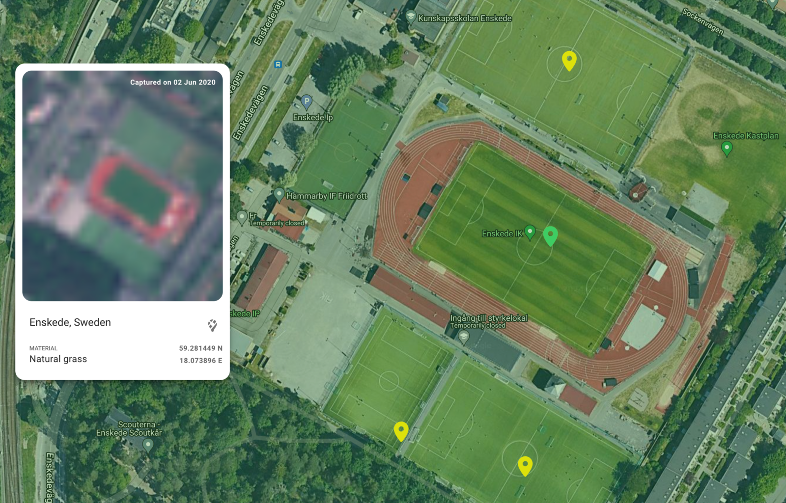
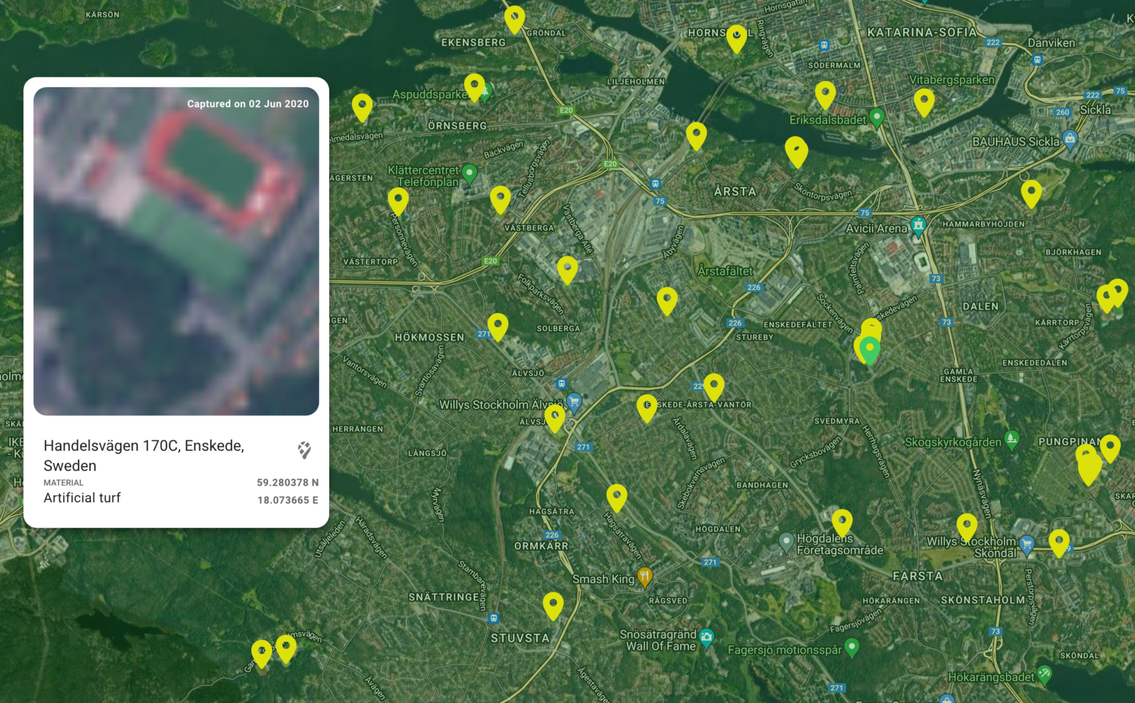
Proekspert developed a platform that lets users select geographic areas of interest, analyzes ESA satellite images with machine learning algorithms, and delivers a mapped list of football fields – distinguishing between natural grass and artificial turf.
Key features:
- Automated satellite image processing with machine learning
- Distinction between natural and artificial turf
- Interactive web mapping interface
- Links to field locations for further review
- Extendable to more regions and use cases
This solution turns complex satellite and field data into actionable business intelligence for planners, manufacturers, and facility managers.
Replacing manual surveys with automated football field and turf detection
Proekspert’s solution automates the mapping of football fields and turf type, replacing costly manual surveys. Facility planners, turf manufacturers, and sports organizations now access field locations and surface data instantly through an intuitive, interactive interface using satellite imagery.
This direct access to field data enables better decisions for construction, renovation, compliance, and maintenance. The flexible platform supports future growth and evolving business requirements.
Up-to-date intelligence on field composition and condition is now accessible and affordable, reducing planning friction and supporting smarter investment choices.
Impact for the client’s organization
Sponsored by the European Space Agency, this solution delivers tangible benefits to facility managers, turf manufacturers, and planners by making football field data easier to access and act on:
- Facility owners and planners cut costs and save time by replacing manual surveys with automated satellite-based mapping and turf analysis.
- Accurate surface and location data supports improved planning, construction, and operational decisions.
- The solution is scalable and can expand to new regions and future feature needs.
Client
The European Space Agency (ESA) is Europe’s leading organization for space exploration and innovation, enabling cross-industry advancement through satellite technology and business applications. ESA’s Business Applications Space Solutions (BASS) program co-funded this project to unlock new commercial uses for satellite imagery in facility management.
Technologies
U-net, OpenCV, Postgres, CouchDB
Related case studies
Our case studies give an insight into how human-oriented design principles will help product companies persuade customers to go on a journey with smart, connected products.


Share your challenge with us
Thank You!
Your message has been sent. Our team will get back to you as soon as possible!
Proekspert AS
Tallinn headquarters
Sõpruse pst 157
13417 Tallinn
Estonia (EU)
Reg code 10331577
VAT no EE100185388


© 2026, Proekspert AS


